I didn’t take Australian history during my final years in school. Therefore my knowledge of Australian history is only at a general level. My knowledge can be quickly summarised using the following dot points:
- Indigenous Australians are the original people of Australia
- The Dutch came across Australia, but chose not to settle
- The British came across Australia in 1788 and decided to settle and use Australia as a dumping ground for convicts
- Indigenous Australians were killed and treated poorly, only receiving equal status in 1967 via a nationwide referendum
- The states operated independently, before being brought together by Australian Federation in 1901
- Canberra was a purpose built capital territory, situated half way between Sydney and Melbourne
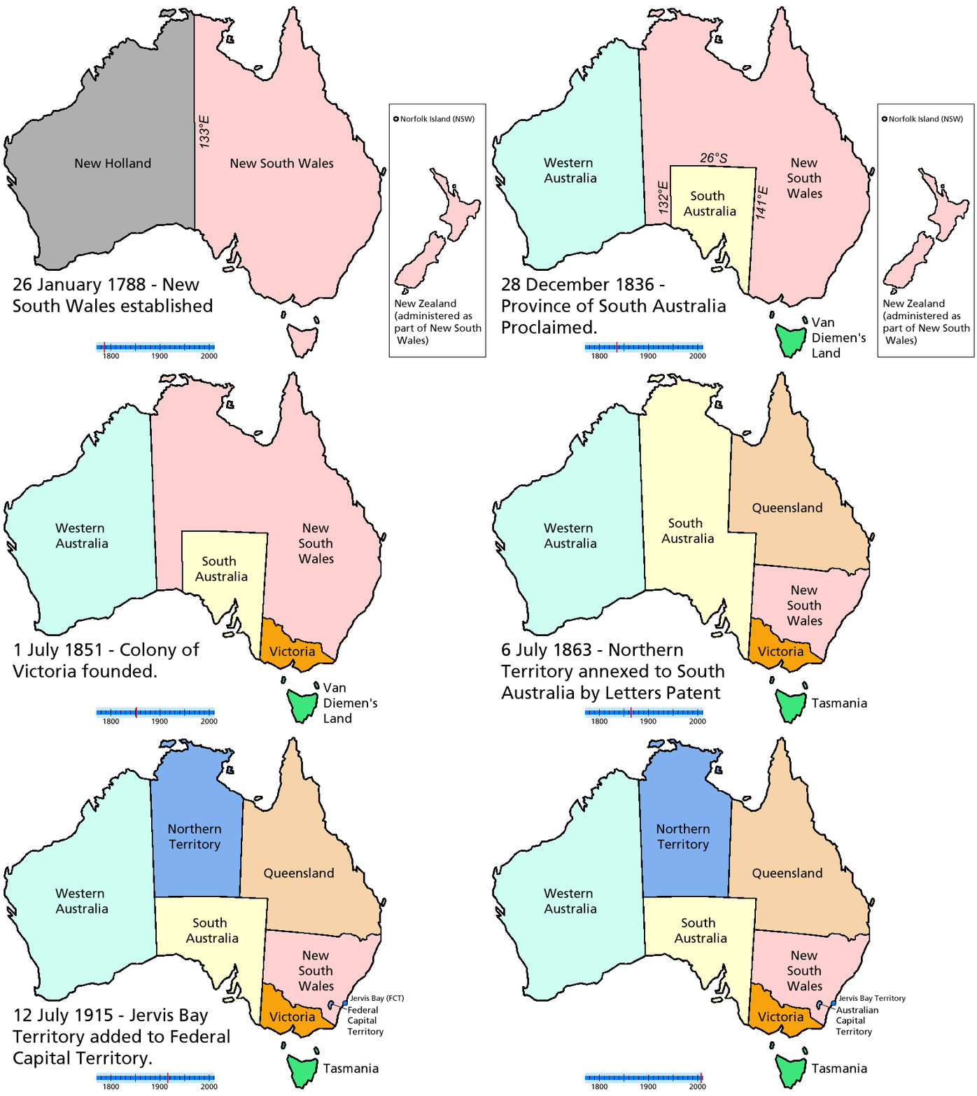
So imagine my surprise when I came across this animated image of Australia. It shows a moving history of Australia’s state borders.

Australia’s state boundary changes. Source unknown.
Slap me down with a feather, but I didn’t know about New Holland being a region. or that the top of Australia was named South Australia.

